Home / Workers / Site Scan

Your site, measured.
No drones. No permits.

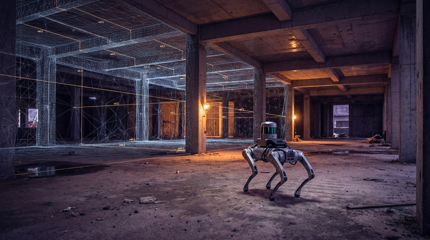
Runs on a Deep Robotics quadruped — X30 Pro or Lynx M20, both carrying the full sensing pack — thermal PTZ, acoustic, gas, RTK. Authorised Deep Robotics distributor in the UAE.

Ground-based LiDAR scanning of villa and building sites: cut/fill volumes, stockpiles, progress against drawings — delivered within 48 hours of each visit. Drone surveys need aviation permits for every site; our scanner walks in with the crew.

Book a scan on WhatsApp
WOLKER robot worker scanning a concrete building shell with LiDAR, wireframe capture overlay
A scan visit takes under 2 hours. Reports in 48.

For asset owners

For the party carrying the payment risk

A progress dispute is settled with the developer’s money, not the contractor’s. The scan gives the party paying for the works an independent measurement of what was actually built, delivered in the formats their consultant and quantity surveyor already work in, so the figure can be checked rather than argued.

What you get

Numbers that hold up in a dispute

Volumes

Cut/fill, backfill and stockpile volumes at ±3 cm class accuracy — the measurement standard accepted for earthworks.

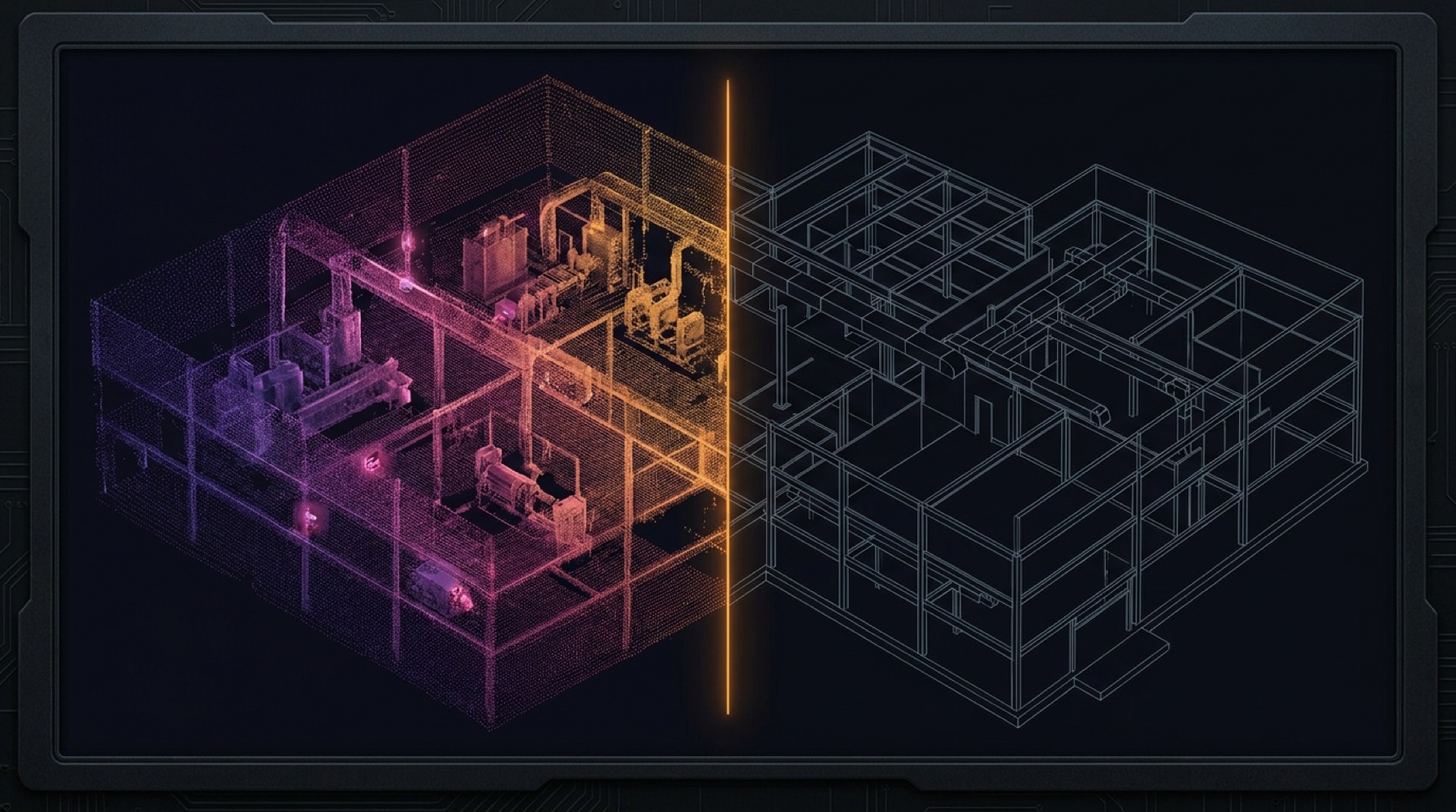
Progress vs drawings

Point cloud compared against your IFC set: what is built, what deviates, what is behind.

Tamper-proof record

Every scan is hash-sealed as a UAE-compliant e-record. When a payment application is challenged, your measurement stands. See what is inside the report.

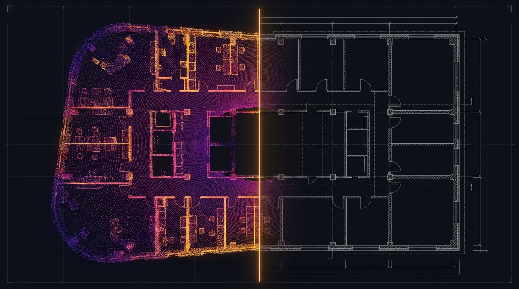
Automatic floor plans

2D plans derived automatically from every scan — no survey crew, no waiting. Delivered with each report.

Open formats

Point clouds in E57/LAS — your consultants and BIM team work in their own tools, no lock-in.

Drainage & Channel Scan

Culverts, channels and voids where people can't go — scanned by the robot worker. See the service →

Point cloud transitioning into an automatically derived 2D floor plan
POINT CLOUD → AUTOMATIC 2D FLOOR PLAN
Point cloud compared against the BIM/IFC model with deviations highlighted
POINT CLOUD ↔ BIM/IFC MODEL · DEVIATIONS FLAGGED

Packages

Three ways to start

One-time

Site Scan

Full site scan + volume and deviation report. Credited against a subscription if you continue.

AED 8,900 · one-time

Monthly

Progress Subscription

Two scheduled visits per month, reports within 48 h, full point-cloud archive of your project.

AED 8,900 · per month

Project

Milestone Pack

Three scans — shell, pre-fit-out, handover — plus the as-built point cloud for your records.

AED 24,500 · per project

Scan slots are booked in order of enquiry. Where a certified quantity sign-off is contractually required, it is issued by your appointed licensed surveyor — we deliver the point cloud and the figures in E57 and LAS so they can sign against them.

How it works

From enquiry to first report

  1. Send your site location and drawings (IFC/PDF) on WhatsApp or email.
  2. We confirm scope and schedule the first visit — under 2 hours on site.
  3. Within 48 hours: volumes, deviation report and archive access.
  4. Repeat on schedule. Every visit builds your as-built record.

Book a scan

FAQ

Construction site scanning — the questions we get

What accuracy do the volumes have?

Cut/fill, backfill and stockpile volumes at ±3 cm class accuracy — the measurement standard accepted for earthworks.

What does it cost?

A one-time Site Scan is AED 8,900 and is credited against a subscription if you continue. The Monthly Progress Subscription is AED 14,900 per month for two scheduled visits with reports within 48 hours and a full point-cloud archive. The Project Milestone Pack is AED 24,500 for three scans — shell, pre-fit-out and handover — plus the as-built point cloud.

Will the measurement hold up in a payment dispute?

Every scan is hash-sealed as a UAE-compliant e-record, so when a payment application is challenged the measurement stands. Where a certified quantity sign-off is contractually required, it is issued by your appointed licensed surveyor — we deliver the point cloud and the figures in E57 and LAS so they can sign against them.

Do we get locked into your software?

No. Point clouds are delivered in E57 and LAS, so your consultants and BIM team work in their own tools. Two-dimensional floor plans are derived automatically from every scan and delivered with each report.

Do you need drone permits?

No. The scanning is done by a ground robot, so no drone permits are involved. A site visit takes under two hours and the report follows within 48 hours.